

© Apple + 01net.com
The new Maps have arrived! It is accompanied by its new base map, its more precise roads, its more detailed buildings, its functional innovations which sometimes smell good of augmented reality, and appreciable progress in the guidance on foot, by car or in transport. in common. On the other hand, forget the bike, it’s not for this time.
We had been waiting for… four years. Introduced in June 2018, during the WWDC opening keynote, but initially reserved for a handful of countries, such as the United States, the new Plans is finally arriving in France.
Why “finally”? Because in addition to the passage of time, the list of countries that benefit from it has grown over the years. It now has around ten countries, including the United States, the United Kingdom, Ireland, Canada and even Spain, Portugal, Italy and Germany. The good news is therefore that France and Monaco are joining this big family this Friday, July 8, 2022.
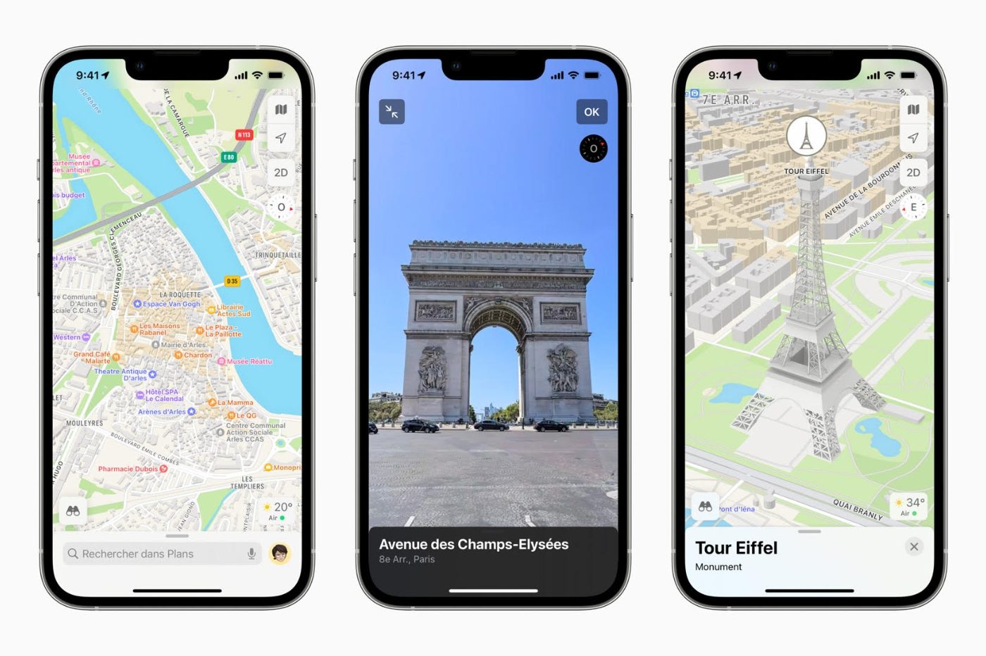
What is the new Plans?
After the new start in iOS 6 in 2012, and the many problems that we remember, sometimes funny and sometimes on the brink of tragedy, Apple had, with iOS 12, decided to overhaul its mapping and navigation software.
At the heart of this move upmarket, intended to catch up with Google, there was of course a more readable, more precise and more detailed base map, which required specially equipped vehicles but also pedestrians to travel millions of kilometers. The map has therefore improved outdoors, but also indoors, with the mapping of certain buildings, whether airports or shopping centers. It is thus possible to avoid getting lost in the maze of corridors of an unknown terminal or between stores to arrive directly at your objective.
Gradually, and especially with iOS 15, Apple has also introduced new functions.
We are thinking, among other things, of 3D experiences to better take the measure of buildings and spaces in certain cities, such as Paris, Lyon, Marseille, Nice, Monaco or even Carcassonne and La Rochelle. Without forgetting the Look Around function, which allows from the classic map, by pressing a button representing small binoculars, to see a monument in photo.
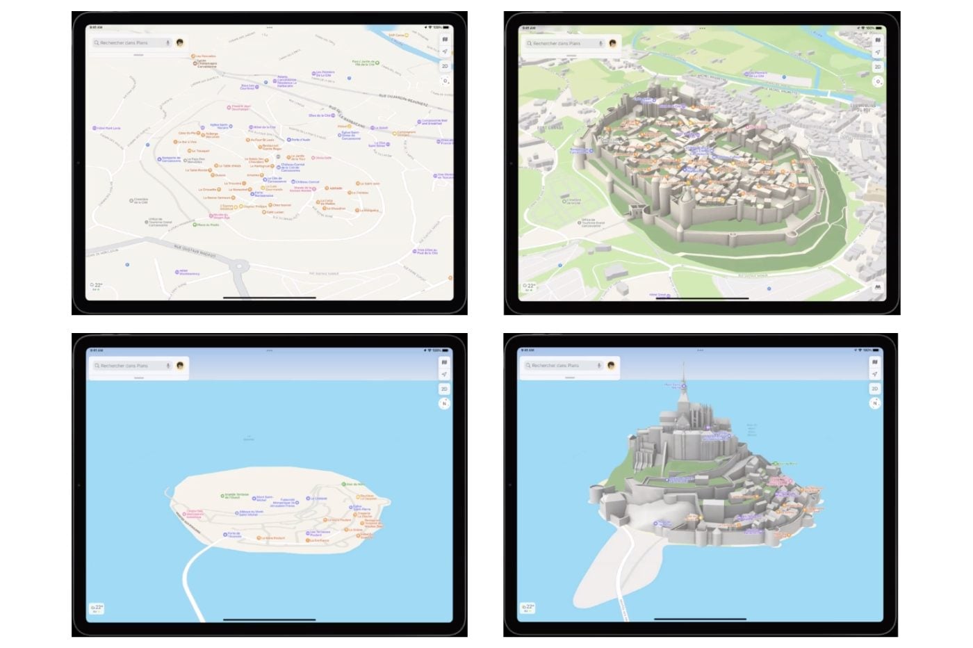
All these advances and novelties are therefore available in France from July 8th.
More detailed and natural navigation
But the most useful progress on a daily basis is the navigation system. French users now benefit from the highest accuracy of the basemap, especially for roads, which allows you to better guide you. So when changing lanes, on a sprawling freeway interchange, the view changes to give you a more detailed representation of which lanes exist in front of you and which one you need to take.
In addition, Apple indicates that it has worked to improve the instructions now given in natural language (or more natural, in any case). You will not just be told to turn right, but to “position yourself in the right lane after the traffic light so that you can take the first road on the right”, for example.
Among the information also added, speed limits. Plans, like most of its competitors, tells you what speed to respect on the section you are taking.
This heightened level of detail is also available when using public transport. Provided you have a connection to the mobile network to locate you precisely, Maps can thus warn you when you approach the station where you have to get off.
If you are more of a relentless pedestrian, the new Maps also offers to guide you in augmented reality in cities like Lyon, Marseille, Nice, and of course Paris. You then follow the steps one by one. To activate, simply point your iPhone’s camera at a building, Maps will then determine where you are, and show you onscreen superimposed on the real world where to go.
One is missing!
In short, Apple is strengthening the appeal of its service for users who travel by car, on foot, by public transport, and by bicycle… Ah, no. Surprisingly, the bike route calculation function is still not available in France (and Monaco). Routes optimized according to the slope, pollution zones, etc. are therefore still not on the agenda in France. That’s a shame. This is one of the reasons why many iOS users, including us, continue to use Google Maps or other applications, such as Geovelo, Komoot, etc.
Obviously, Apple has no date to communicate for the future availability of this function. We just know that the work is underway and, given the exponential development of cycle paths in France since the pandemic, listing and mapping them is no small task. In any case, the Plans team has learned from its past setbacks and ensures that it wants its work to be completed before being placed in the hands of everyone.