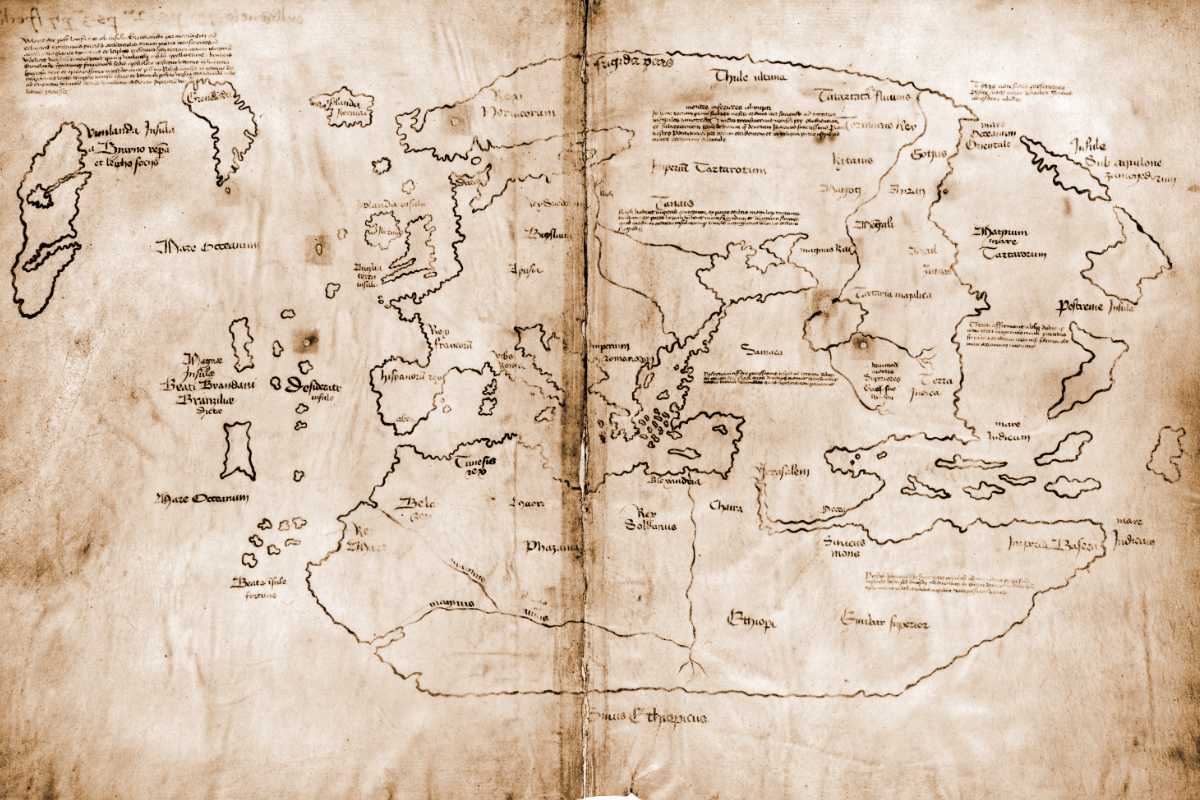
The map – which suggested that the Vikings already visited the New World before Columbus – appears to date not from the fifteenth, but from the twentieth century and is a deliberate forgery.
So say researchers at Yale University, where the map is stored. “The Vinland map is fake,” said researcher Raymond Clemens. “There is no reasonable doubt here.”
The discovery
The map in question became world news in 1965 when Yale University researchers announced its existence. The map – showing Viking discoveries in Greenland and Vinland (part of North America) – is believed to date from the fifteenth century. The map would thus show the oldest image of the New World and prove that the Vikings reached this New World before Christopher Columbus.
Doubts
A great find. If the map was real, that is. And that was actually doubted immediately after it was presented to the world in 1965. The doubt was further fueled years later when researchers showed that modern inks had been used in several places on the map.
New research
And now researchers have reconsidered the map. This time they studied the composition of all the ink on the map. They also made use of technologies that were not available until recently. It leads them to an unmistakable conclusion. The Vinland map is fake.
Ink
The researchers draw this conclusion based, among other things, on the fact that both the text and the drawings were applied with ink containing titanium. Such inks did not appear on the market until around the 1920s. It means that the forgery must have seen the light of day sometime after 1920.

Using special imaging techniques, researchers mapped the use of titanium-containing inks. Here you can see where titanium was found. Image: Yale University.
Deliberate Forgery
The research also strongly indicates that it is a deliberate forgery and that someone was really out to cheat others. The researchers draw this conclusion on the basis of a Latin inscription that can be found on the back of the map. It appears to be a note from the bookbinder, intended to explain the composition of the book Speculum Historiale to steer in the right direction. The Speculum Historiale is an authentic medieval writing and it is believed that the forger took parchment from this book and then drew his map on it. But what the researchers now show conclusively is that the forger has also traced the note of the bookbinder with modern ink, so that it seems as if the card – which is therefore made with the same ink – was also made of the same ink. Speculum Historiale originates. “The modified inscription certainly seems to be an attempt to trick people into believing that the map was made at the same time as the Speculum Historiale,” said Clemens. “It’s strong evidence that this is a forgery and not an innocent creation by a third party that was then picked up by someone else.” However, it remains unclear who is behind the forgery.
Clemens is happy that it has now been conclusively established that the Vinland map is fake. “We don’t want this to remain a controversy. There are so many fun and fascinating things to study that can actually tell us more about exploration in the Middle Ages.” The Vinland card does keep a place in the Yale University library. “The map has become a historical object,” says Clemens. “It’s a great example of a counterfeit with international impact.”
Source material:
“Analysis unlocks secret of the Vinland Map — it’s a fake” – Yale University
Image at the top of this article: Yale University