Use Google Maps to see how busy it usually is at a location. Avoid the crowds at popular destinations.
Popular times
Google Maps provides more and more information about a location, such as a shop, restaurant or amusement park. In addition to the address, opening times and reviews, Google Maps also knows how busy it is somewhere. Under ‘Popular times’ there is a blue graph that indicates the crowds during opening hours. Some locations even show live how busy it is.
To determine the crowds in a place, Google uses the location data of smartphone users. The users can set whether they share their data with Google.
View crowds via website
View the crowds of a location via the Google Maps website as follows:
- surf to www.google.nl/maps
- Click in the search bar Search in Google Maps.
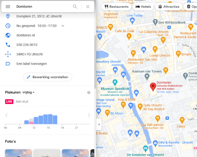
- Type the desired location, for example ‘Domtoren Utrecht’, and press the Enter key.
- All kinds of information about the location appears on the left, including the ‘Peak hours’. Below is a graph showing the crowds.
- If a live indication is also present, it is indicated in pink next to the graph.

View crowds via app
View popular times via the Google Maps app as follows:
- Open the app Google Maps.
- Tap the search bar at the top.
- Enter the desired location, for example ‘Domtoren Utrecht’.
- Tap the magnifying glass icon (Android) or Search (iOS/iPadOS).
- A white area appears at the bottom with information about the location. Tap here.
- Scroll down to ‘Popular Times’. Below is a graph showing the crowds.
If a live indication is also present, it is indicated in pink next to the graph.