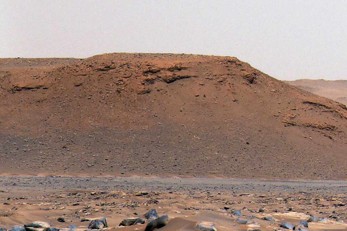
The new images also reveal where the rover can best collect new monsters.
Mars rover Perseverance still haunts Jezero Crater; an area on Mars that scientists suspect was a water-filled crater lake billions of years ago. The crater has long since dried out, causing the rover to make its way across the red, cracked floor. With his camera at hand. And new images now reveal a new slice of Jezero Crater’s intriguing history.
Kodiak
Perseverance took some snapshots of rock formations and cliffs in an ancient delta region on Mars, including a prominent rock dubbed “Kodiak.” In its ancient past, Kodiak was on the southern edge of the delta. Before the advent of Perseverance, the rock had only been photographed from space. But thanks to the Mars rover, scientists are now being treated to close-ups.

Photo of Kodiak rock. Image: NASA/JPL-Caltech/ASU/MSSS
The new photos reveal interesting details about the rock, such as the sequence of successive rock layers along the eastern side. And these in turn provide new information about when the geological deposits took place.
crater lake
It confirms scientists’ suspicions that once rich water flowed through the Jezero Crater. “Never before has such well-preserved stratigraphy been visible on Mars,” said researcher Nicolas Mangold. “This is the most important observation that makes clear once and for all that a lake and river delta existed in the Jezero crater.”
boulders
While that is of course a wonderful result, the researchers were most surprised by the story told by images of cliffs in the northeast of the delta. The researchers discovered similar rock layers to those of Kodiak on the lower half of the steep slopes. But more towards the top, the team found rocks and boulders. “We saw several layers in the sheer cliffs with boulders up to 1.5 meters in size, which we knew had no business there,” explains Mangold.

Several cliffs topped with stones and boulders. Image: NASA/JPL-Caltech/ASU/MSSS
According to the team, there is really only one explanation for this. And that’s that billions of years ago, the fan-shaped river delta of Jezero suffered severe flooding. These brought stones and rubble from the highlands which were then deposited on the steep slopes. Mangold and his team estimate that the torrent of water needed to transport the boulders — some for tens of kilometers — reached speeds of a whopping 6 to 30 kilometers per hour.
samples
The new images also reveal where Perseverance can best collect new monsters. “In our search for organic compounds and biosignatures, we can now best bet on the finest, granular material that is at the bottom of the delta,” said researcher Sanjeev Gupta. “In addition, the boulders found at the top will allow us to sample ancient pieces of crustal rock. Both are therefore on the agenda.”
Jezero Crater
Slowly but surely, scientists are beginning to better understand the Jezero Crater. Early in the history of the former lake, it was believed that the water level was high enough to reach the eastern rim of the crater, where previous images had already revealed the remains of an outflowing river channel. The current study provides additional evidence for this and describes the size of the lake, which was subject to significant change. In this way, the water level rises and falls by tens of meters over time, before the water finally disappears completely. While it is not known whether these water level fluctuations were the result of flooding or more gradual environmental changes, we now know that this did not occur until later in the history of Jezero Crater, when the water level was at least 100 meters below sea level. highest level ever reached.
It probably won’t be long before scientists collect more puzzle pieces. The delta will be the starting point for the next two expeditions of Perseverance. “A better understanding of the Jezero Delta is a key to understanding the change in the area’s hydrology,” Gupta points out. “It could also provide valuable insights into why the entire planet eventually dried up.”
Source material:
“NASA’s Perseverance Sheds More Light on Jezero Crater’s Watery Past” – NASA
Image at the top of this article: NASA/JPL-Caltech/ASU/MSSS