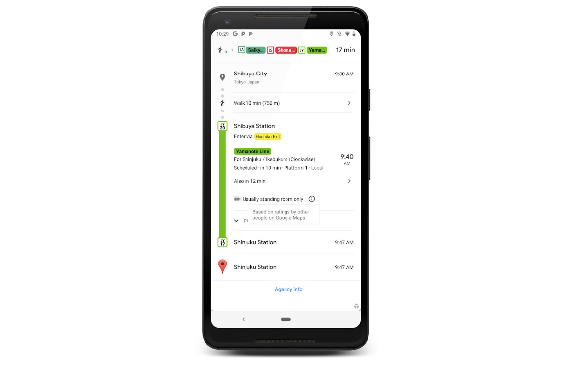
Google Maps has been updated. The navigation service now knows how busy public transport is. For the time being, the new function only works in Amsterdam, Utrecht and Eindhoven.
Google Maps predicts crowds in public transport
In recent months, Google Maps has asked travelers on the bus, metro and train how busy it was. The navigation service knows exactly what the off-peak and peak times of public transport are. From now on, Google Maps will therefore show whether it is getting crowded, or whether you can sit quietly.
Here’s how Google Maps’ busyness indicator works:
- Download and install the latest version of Google Maps from the App Store;
- Plan your trip by public transport as you are used to;
- Maps now predicts how busy it will get.

Do you see five gray people standing by the bus, metro or train? Then it’s cramping, or you better grab the next one if you’re not in a hurry. Do you only see a colored doll? Then there is probably more than enough seating and you can quietly read a book or stare out the window.
For the time being, Google Maps only predicts how busy public transport is in Amsterdam, Utrecht and Eindhoven. It is not known whether the function will soon be rolled out to more Dutch cities. Worldwide, the crowding indicator works in more than 200 places.
Google Maps is getting smarter
Google has been adding one feature after another to the navigation service in recent months. For example, Google Maps has recently warned you about speed cameras, you can navigate to the right plane at Schiphol and you can find menus of restaurants in the area. It is also possible to look up movie times of cinemas nearby in Google Maps.