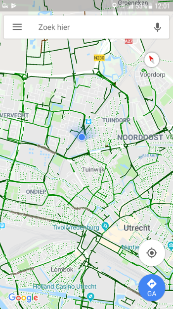
Google Maps is a handy app to find your way around. Also by bike, because the app can show all cycle paths on the map.
Find cycling routes with Maps
Cycling maps from Google Maps (Android)
Here’s how to turn on the ‘Cycling’ layer on an Android device:
- Tap on apps.
- Tap on maps. If necessary, click on the ‘Google’ folder first.
- Tap the circle with a square in it
 .
. - Tap on Bicycles. Optionally, tap the panel to return to the map.
- The ‘Cycling’ layer appears over the map.
- Dark green lines show cycling routes.
- Light green lines are cycle paths.
- Light green dotted lines are bicycle-friendly roads.
- Unpaved trails are marked with brown lines.
Cycling maps from Google Maps (iOS)
Turn on the ‘Cycling’ layer on an iPad or iPhone like this:
- Tap on Google Maps.
- Tap the circle with a square in it
 .
. - Tap on Bicycles.
- Tap the cross on the right.
- The ‘Cycling’ layer appears over the map.
- Dark green lines show cycling routes.
- Light green lines are cycle paths.
- Light green dotted lines are bicycle-friendly roads.
- Unpaved trails are marked with brown lines.
